1889. Cropped image courtesy City of Toronto Archives
Maps
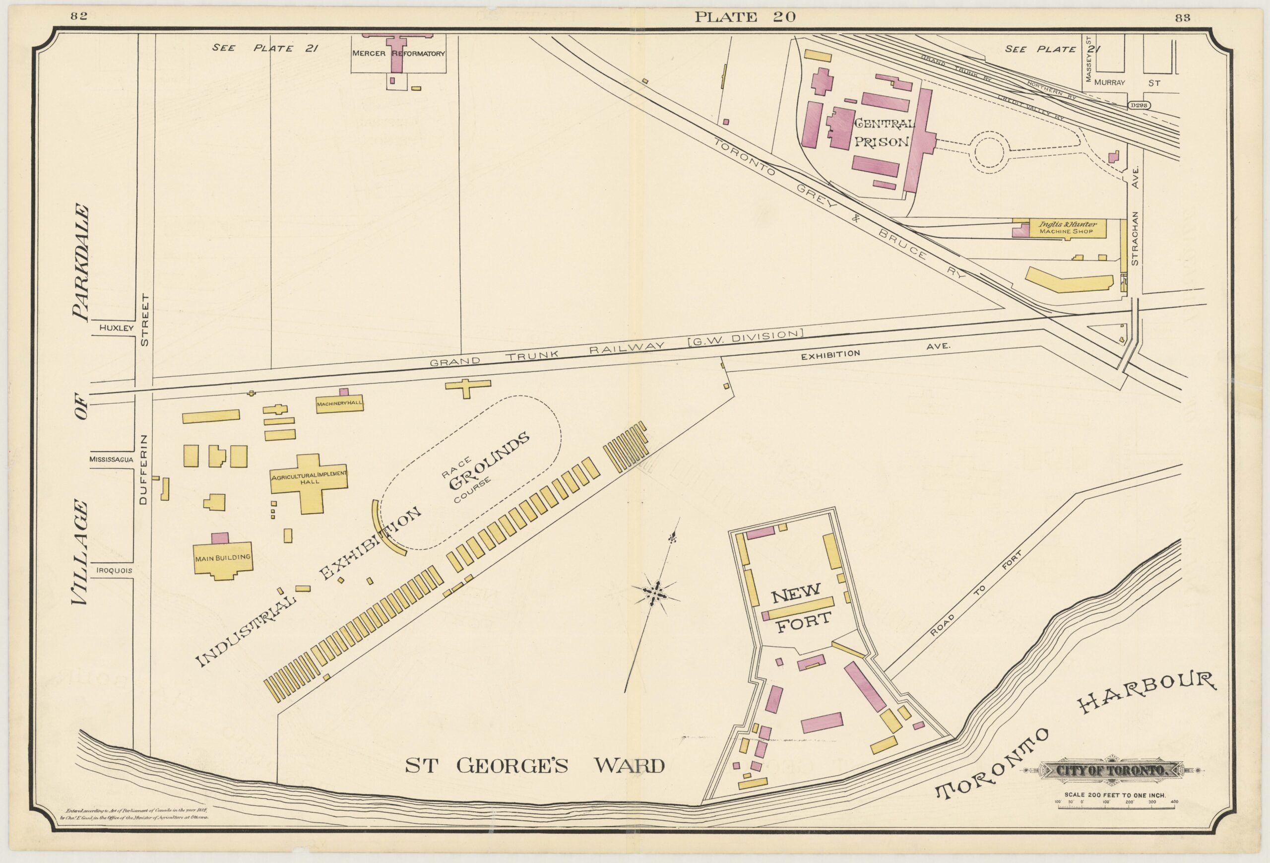
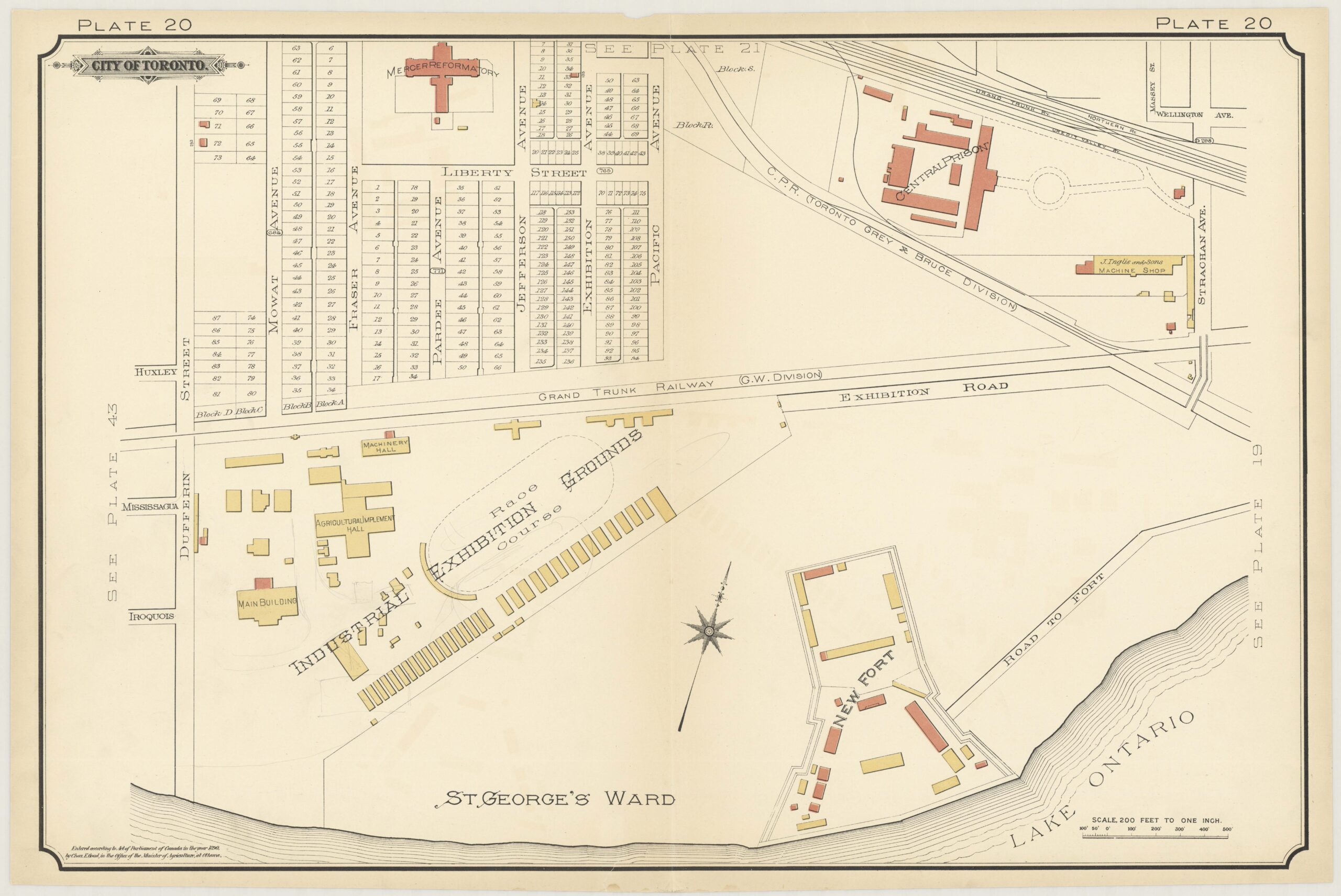
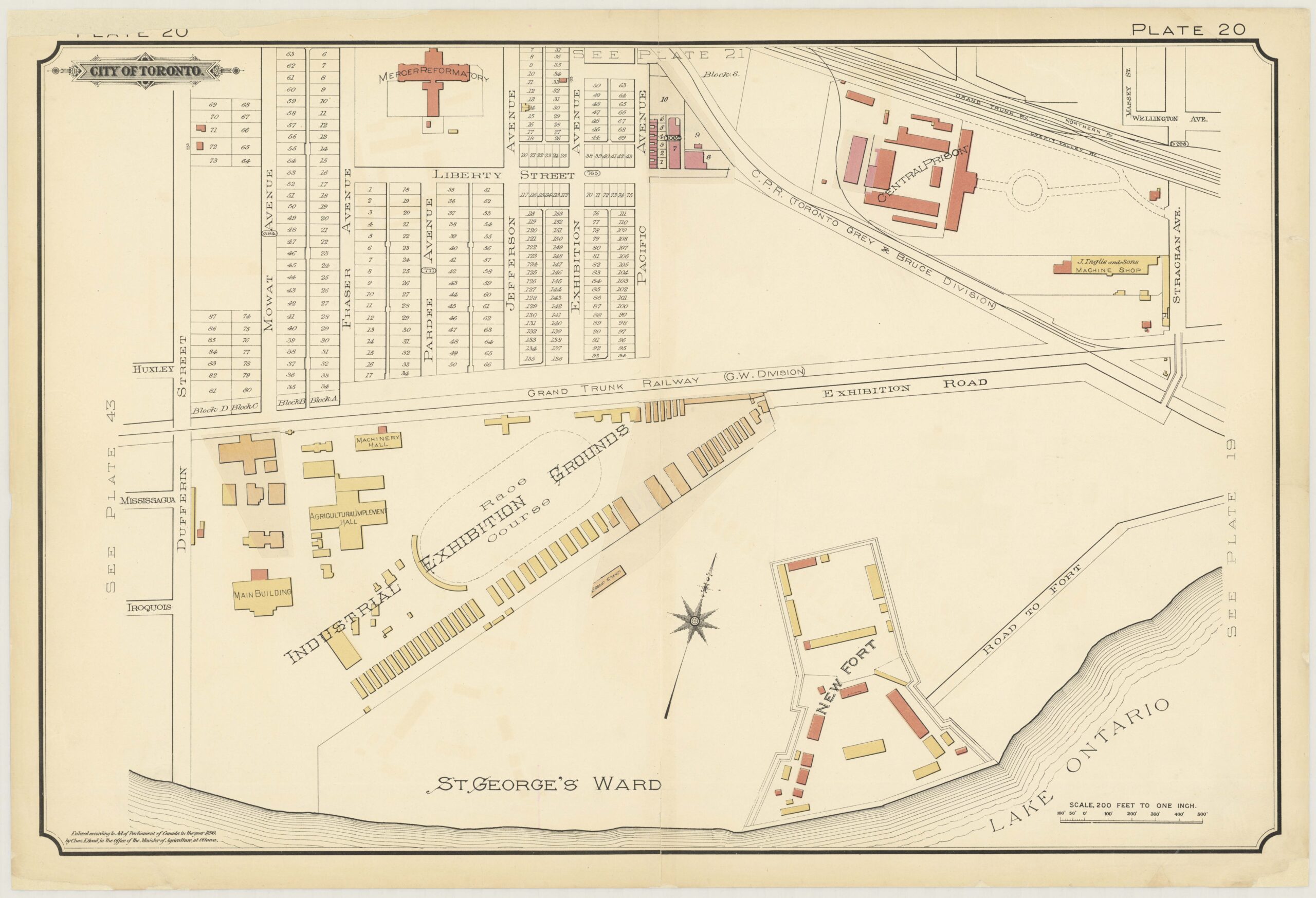
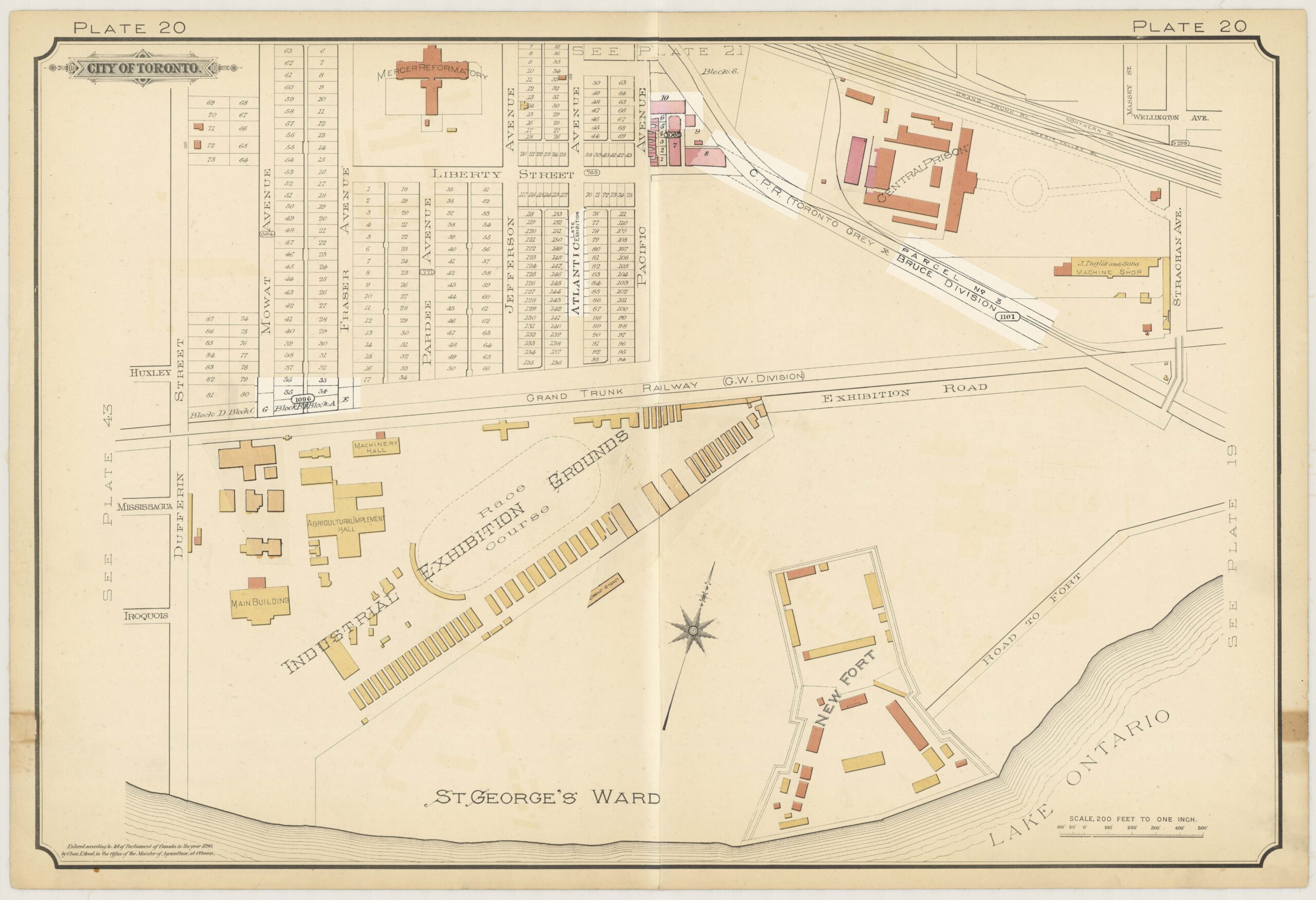
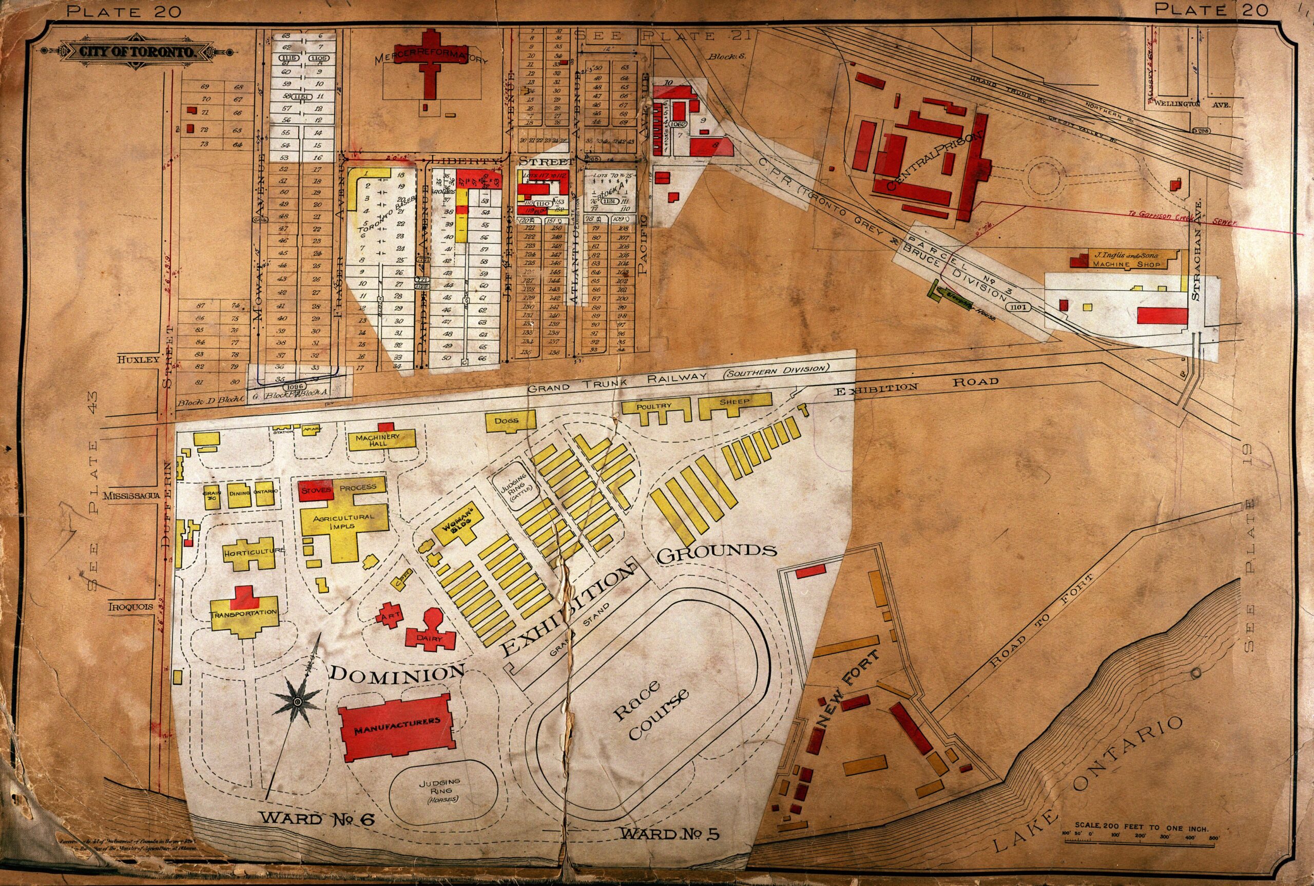
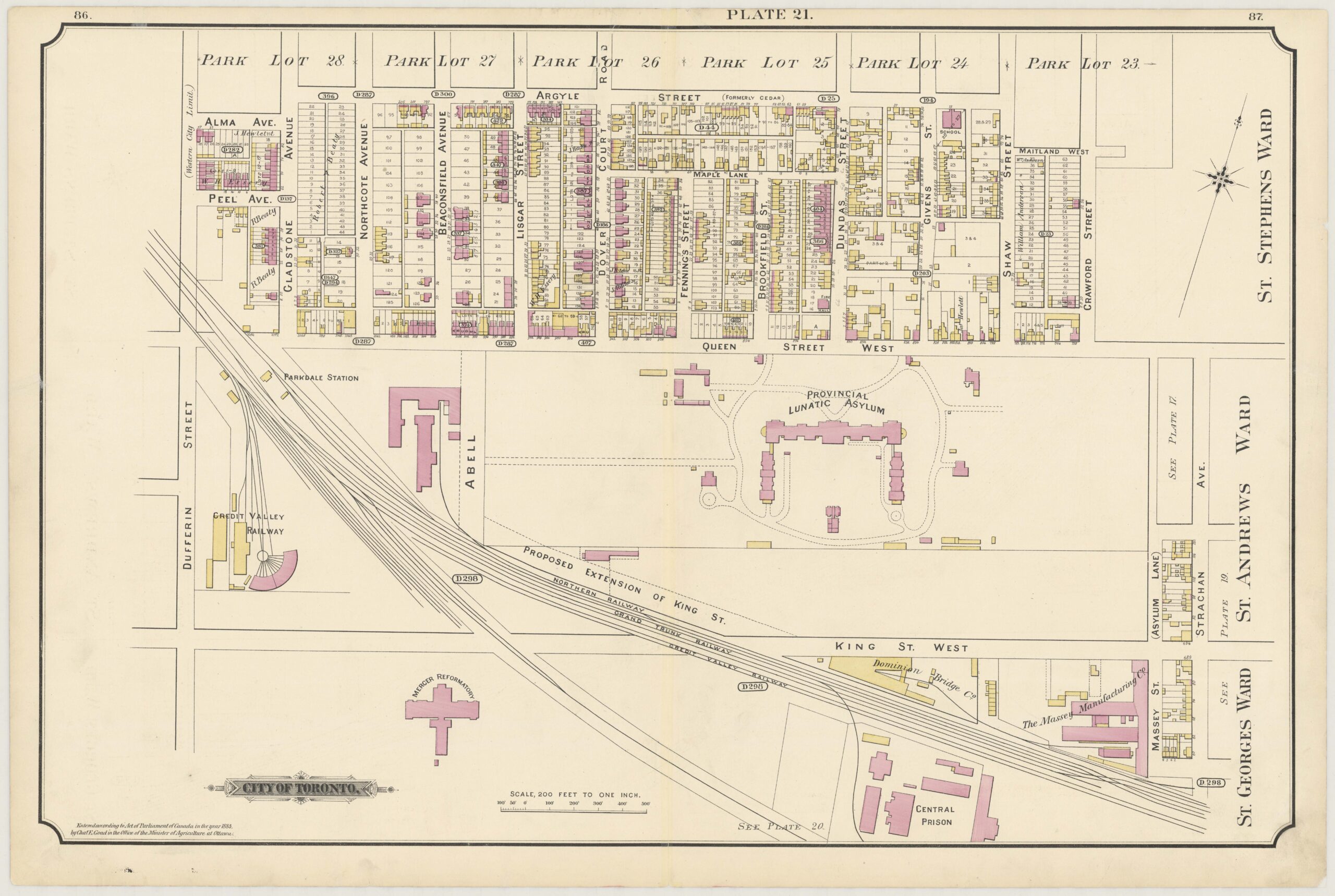
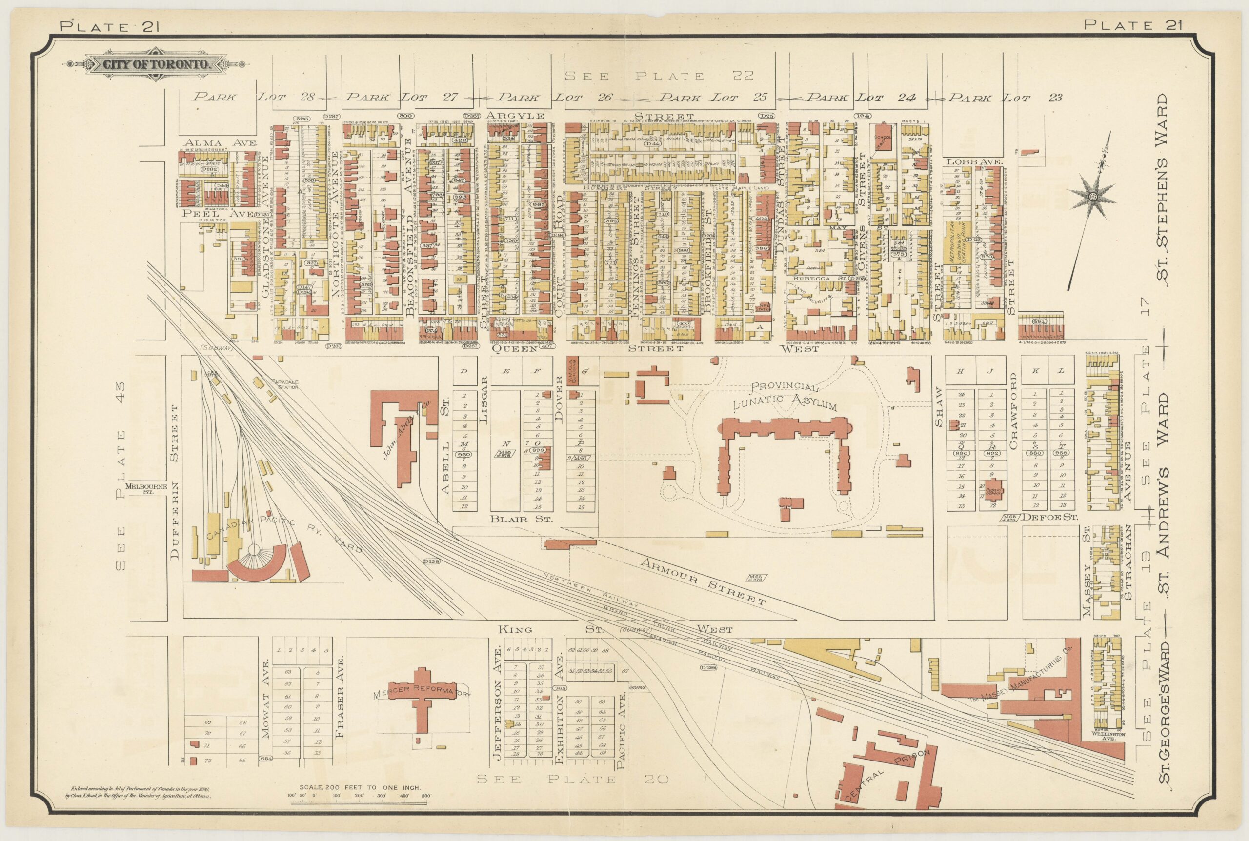
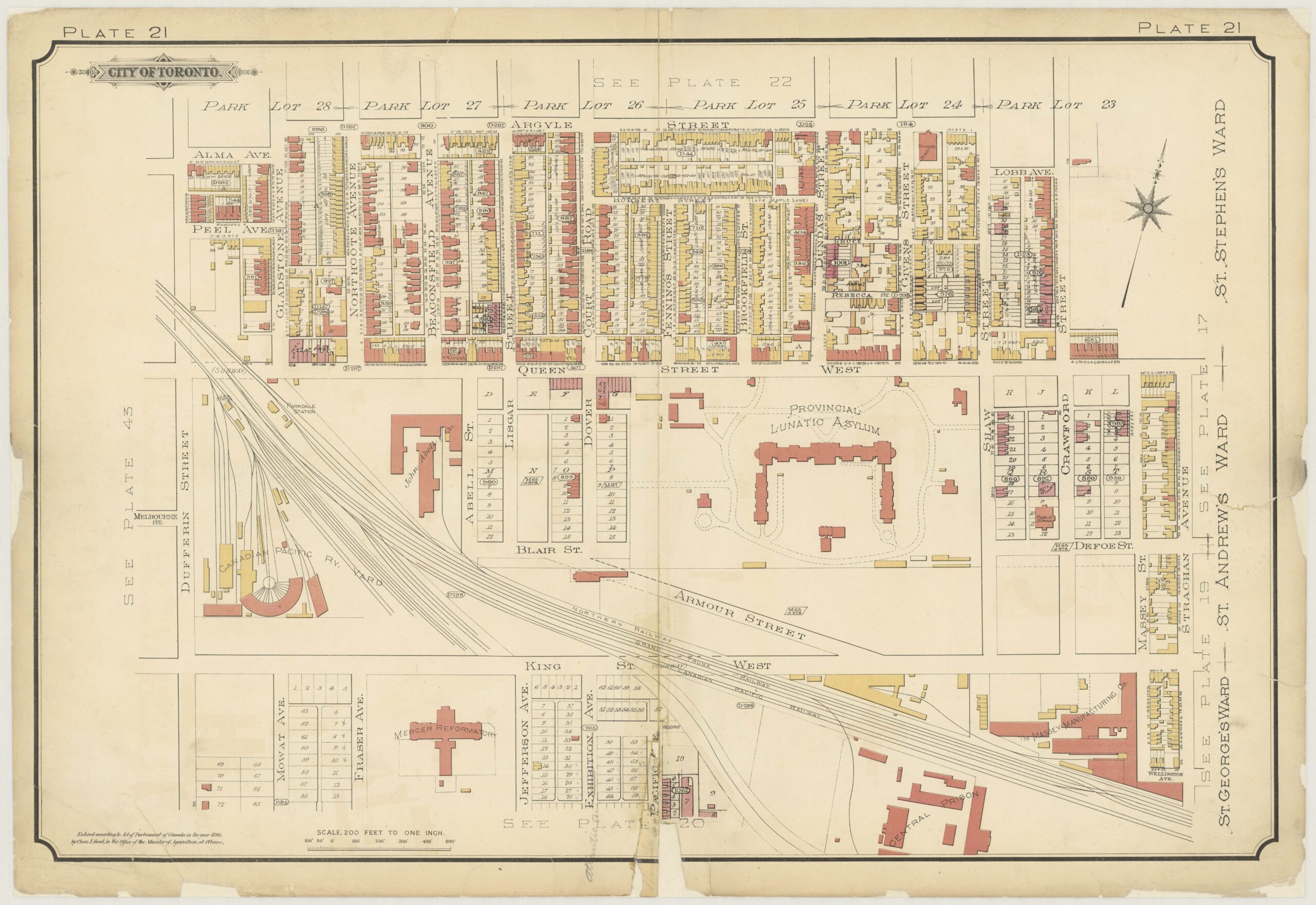
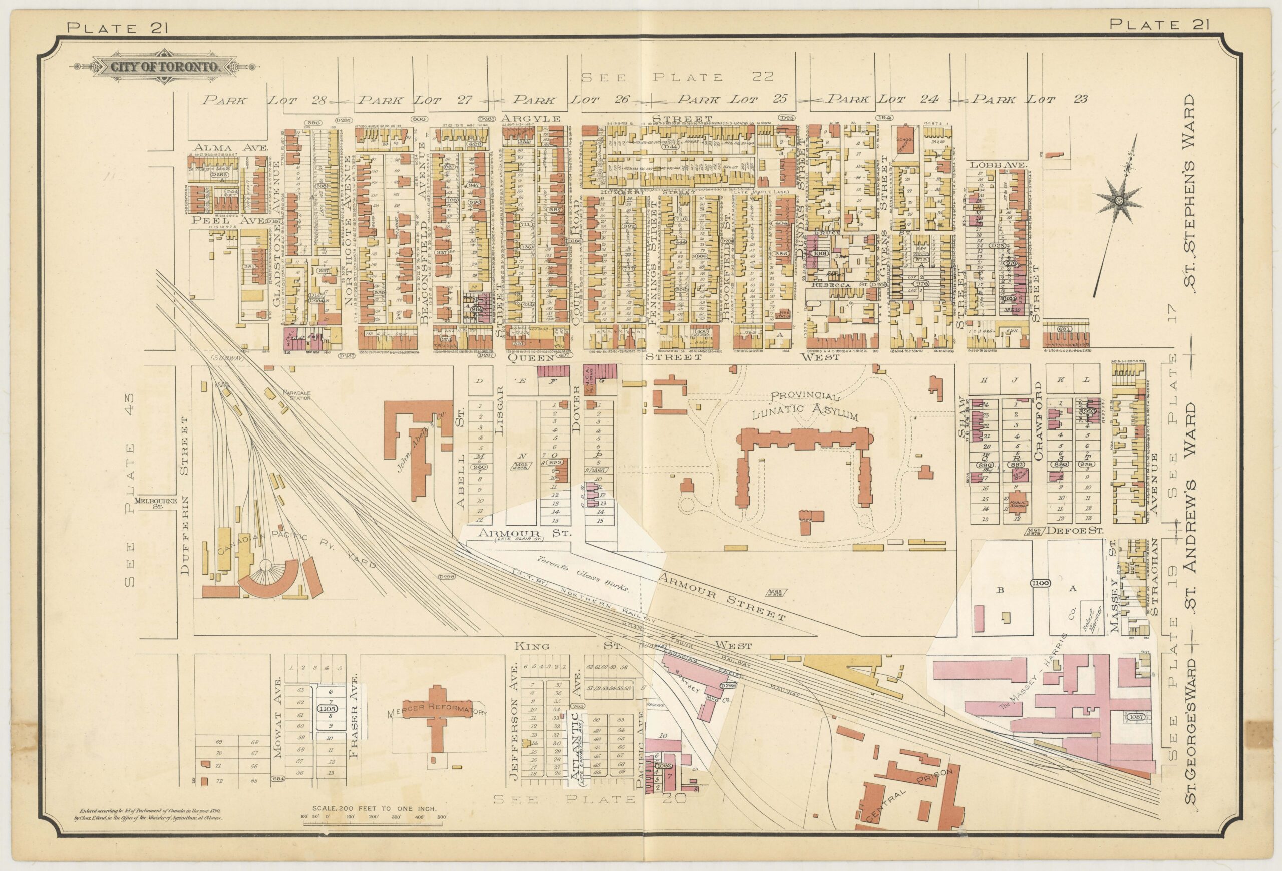
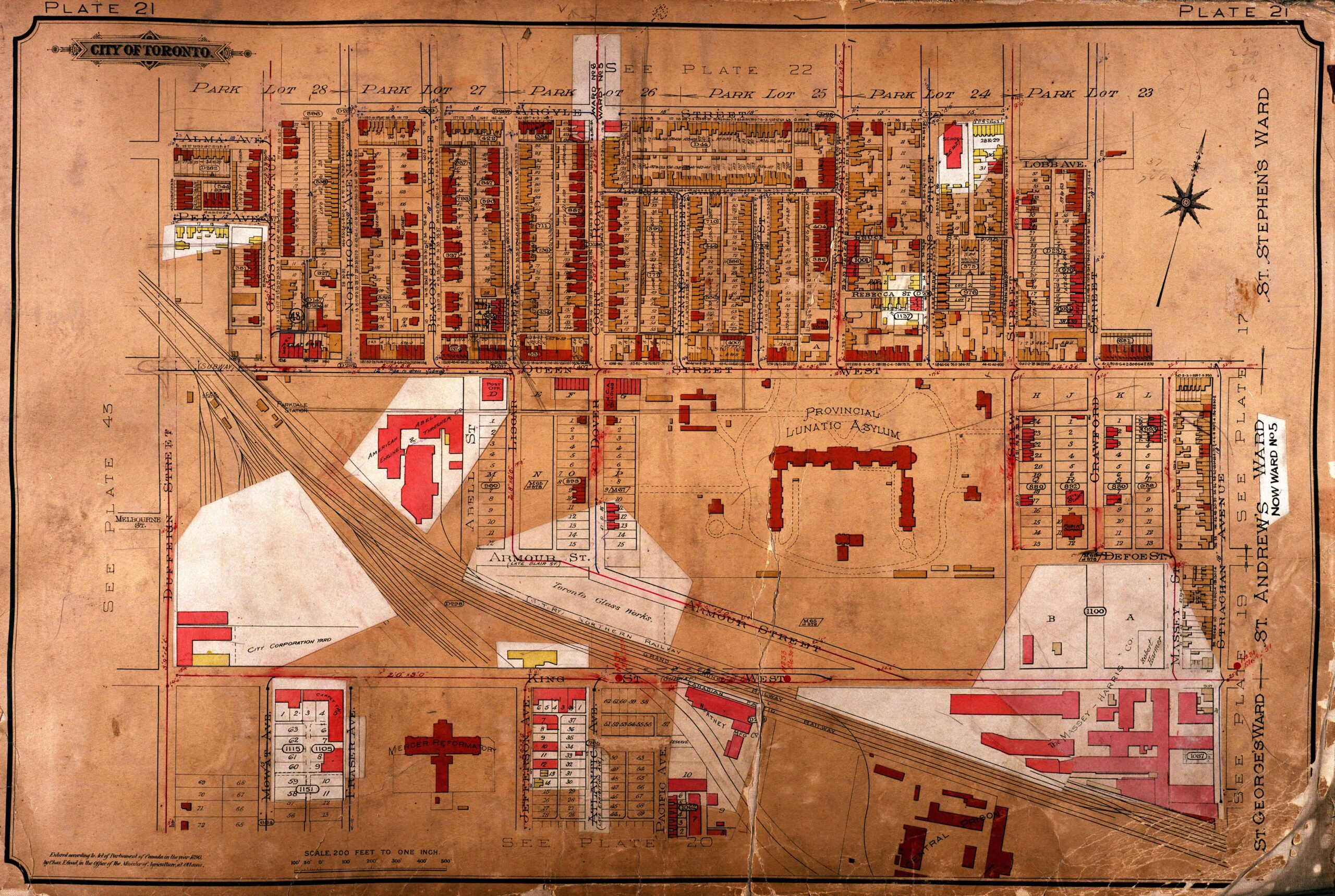
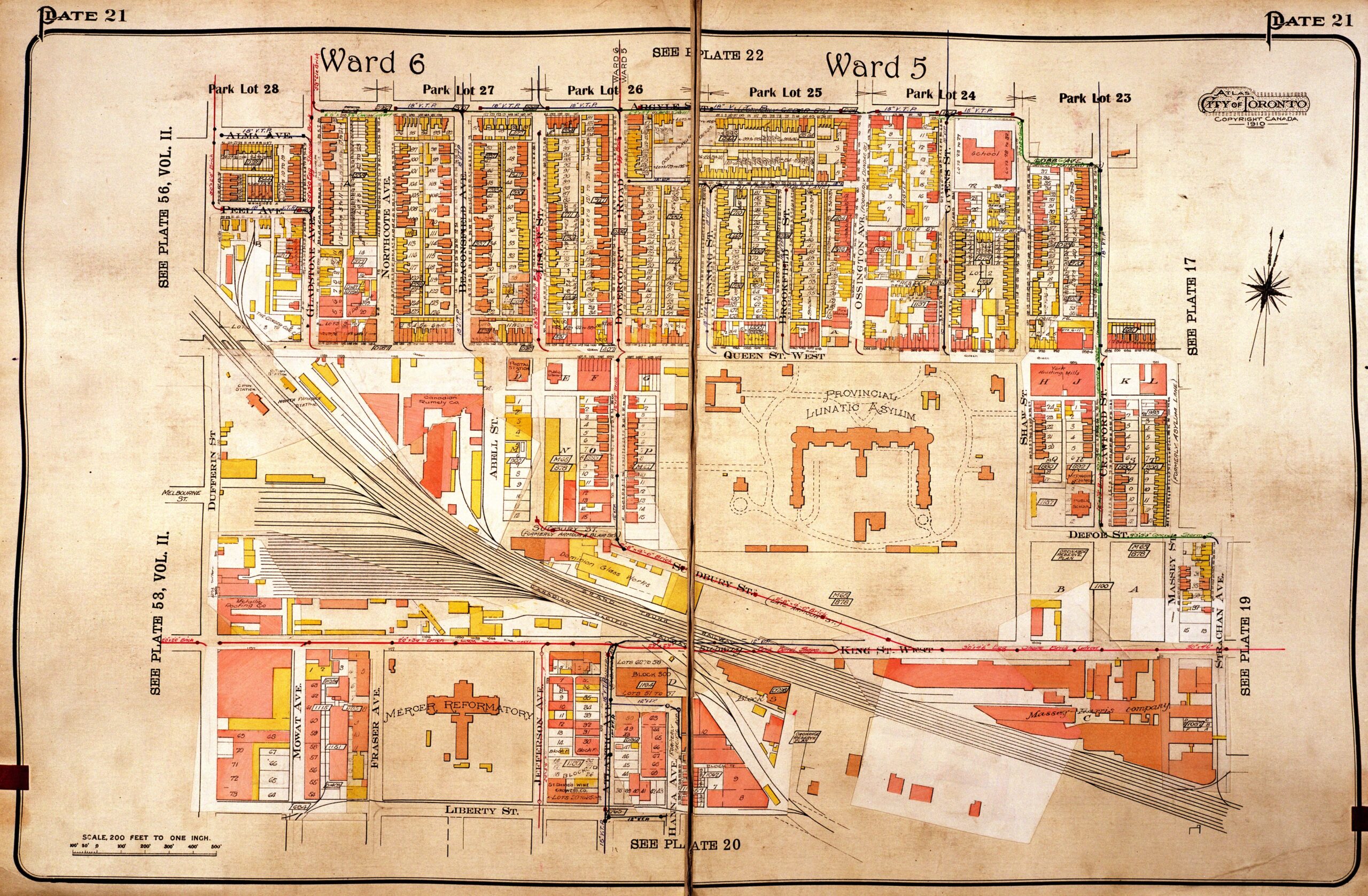
Maps of the Fire Insurance Plans provide a comparative view of the growth of buildings and roadways around the Andrew Mercer Reformatory from 1884 to 1924. Several editions of these maps are located on the City of Toronto Archives website. Each map has numbered sections (called plate numbers) and when clicked on can be enlarged and saved individually.
Incarcerated women and girls at Mercer were often transferred, from, or to, 1 of the 2 Magdalen Asylums in Toronto. The Toronto City Directory of 1903 provides the below street addresses for these carceral institutions.
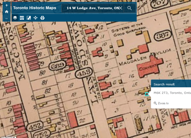
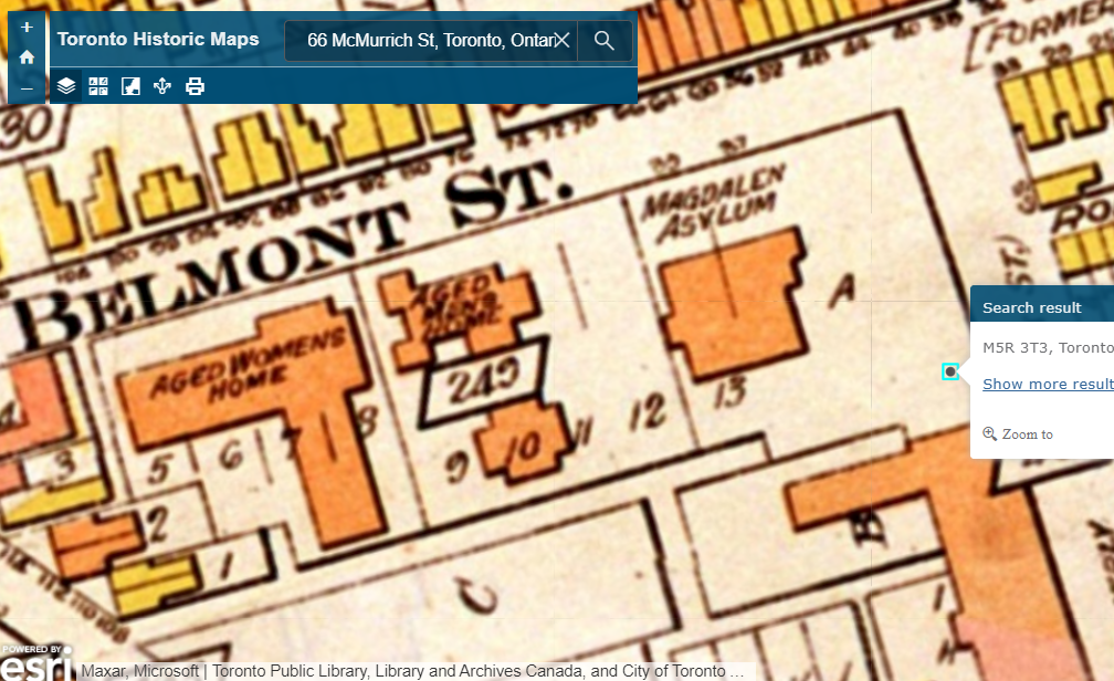
Click on the following hyperlink for the: Searchable Toronto Historic Maps that should default to the 1903 map. Then copy and paste, the bolded addresses below, directly into the search window and increase the size of the image slightly (increase size is found at the top left beside the search window).
Good Shepherd (Labeled Magdalene Asylum in the 1903 map): 14 W Lodge Ave, Toronto, ON, M6K 2T3, CAN
Industrial Refuge (Labeled Magdalene Asylum in the 1903 map): 66 McMurrich St, Toronto, Ontario, M5R 3T3, CAN
If you want to search the historical map for the Andrew Mercer Reformatory use the following address: 1155 King St W, Toronto, ON, M6K 1E9, CAN
14 W Lodge Ave, Toronto, ON, M6K 2T3, CAN
66 McMurrich St, Toronto, Ontario, M5R 3T3, CAN
Aerial Photographs
Aerial view looking east from south end of Dufferine Street
Aerial view [193-?]. A: Massey-Harris. B: Lunatic Asylum. C: Mercer Reformatory. D: Toronto Carpet Factory E: Canadian National Exhibition. Courtesy City of Toronto Archives: fonds 1244, Item 2420
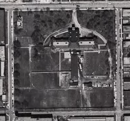
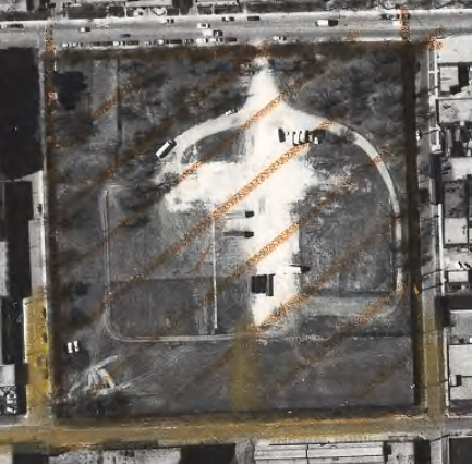
More aerial photographs are available on the Fort York and the Garrison Common website. These comparison images below are from the years of 1962 and after Mercer was demolished in 1971. If you visit the website a clearer picture and better context of the surrounding area is visible.
Series 12, File 1962, Item 44
Series 12, File 1971, Item 28
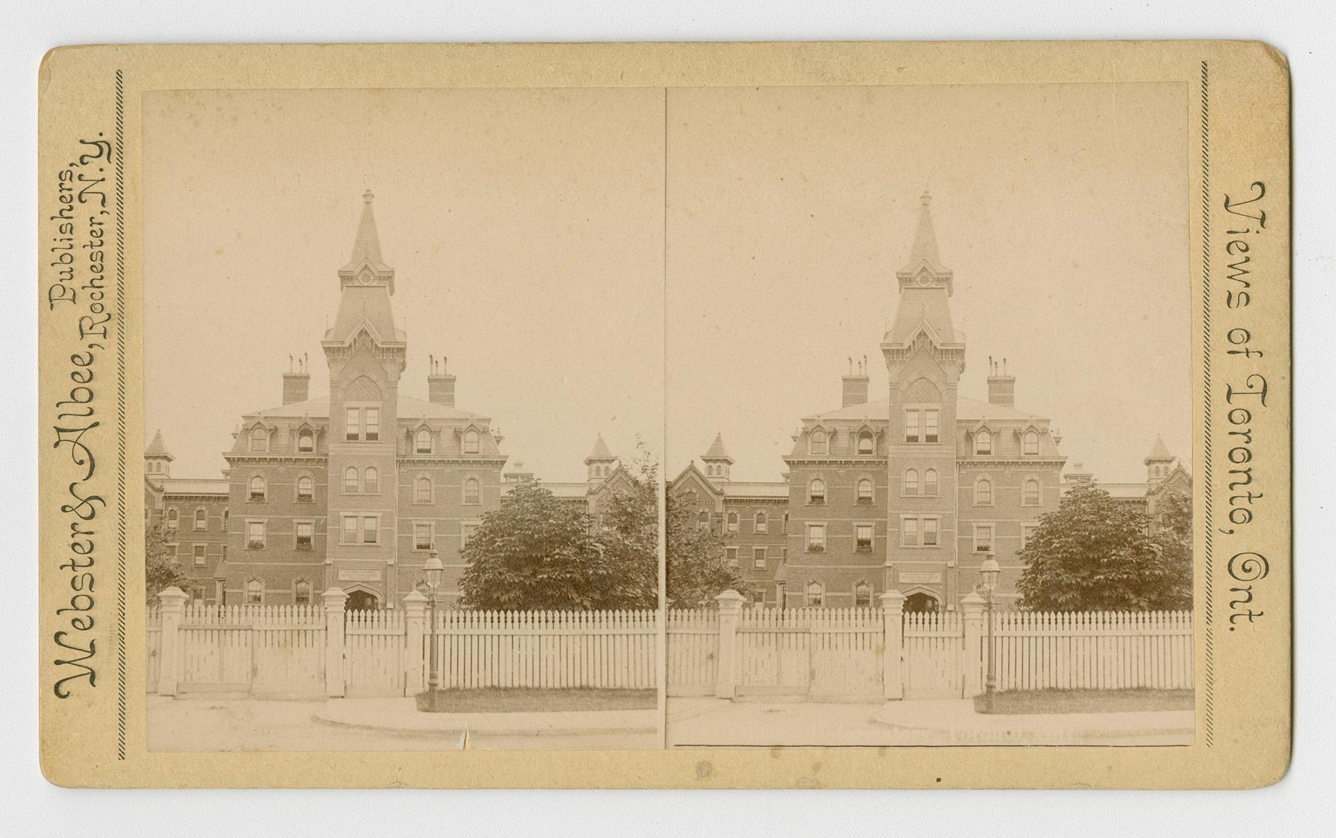
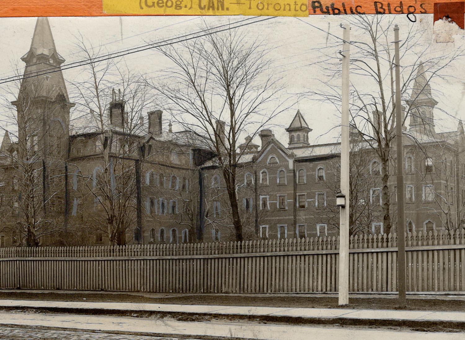
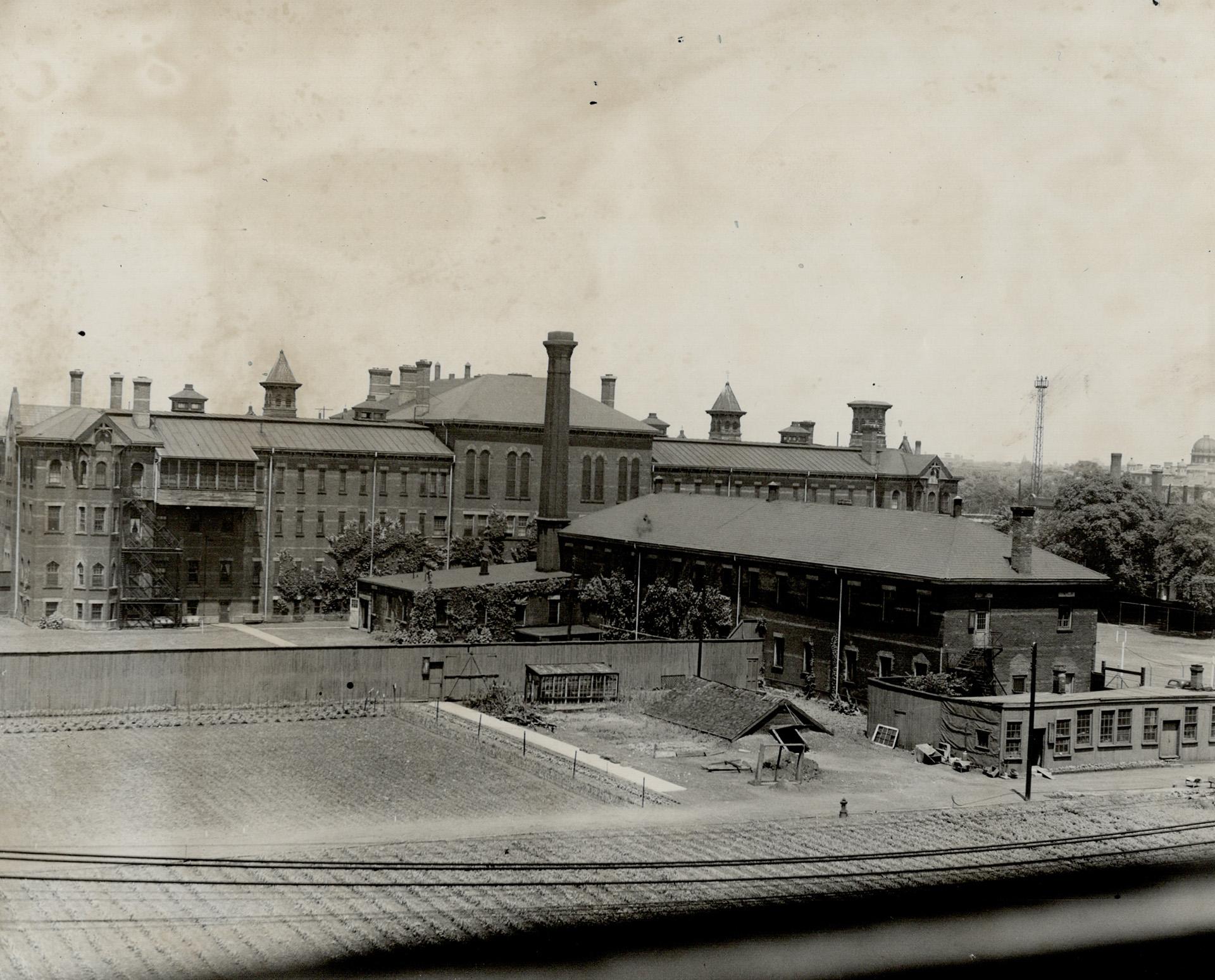
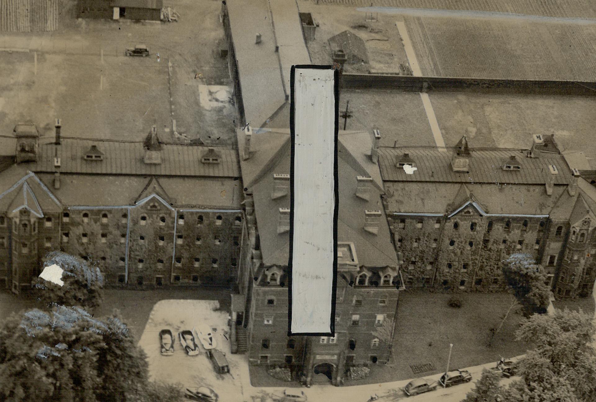
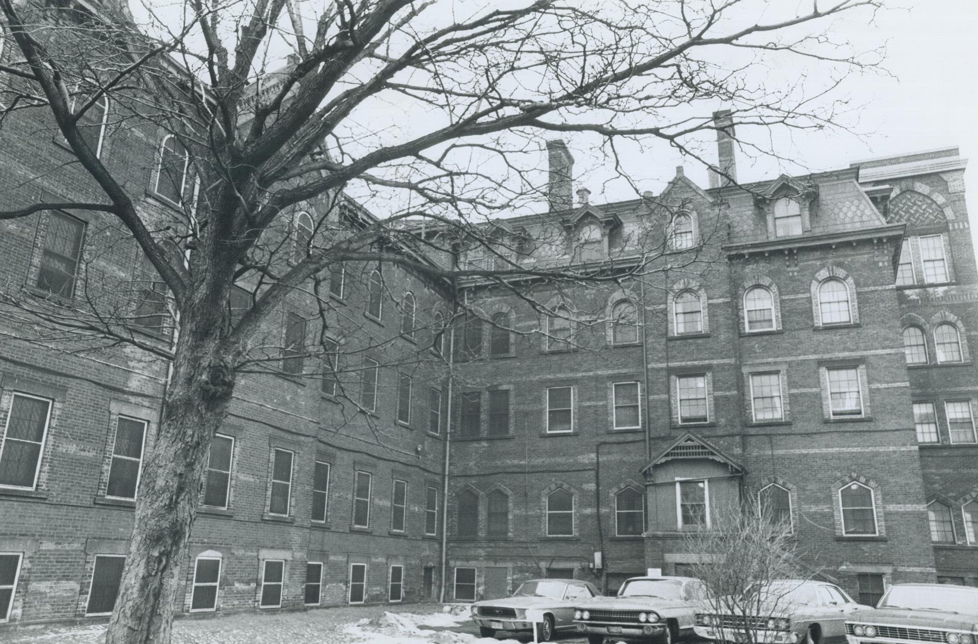
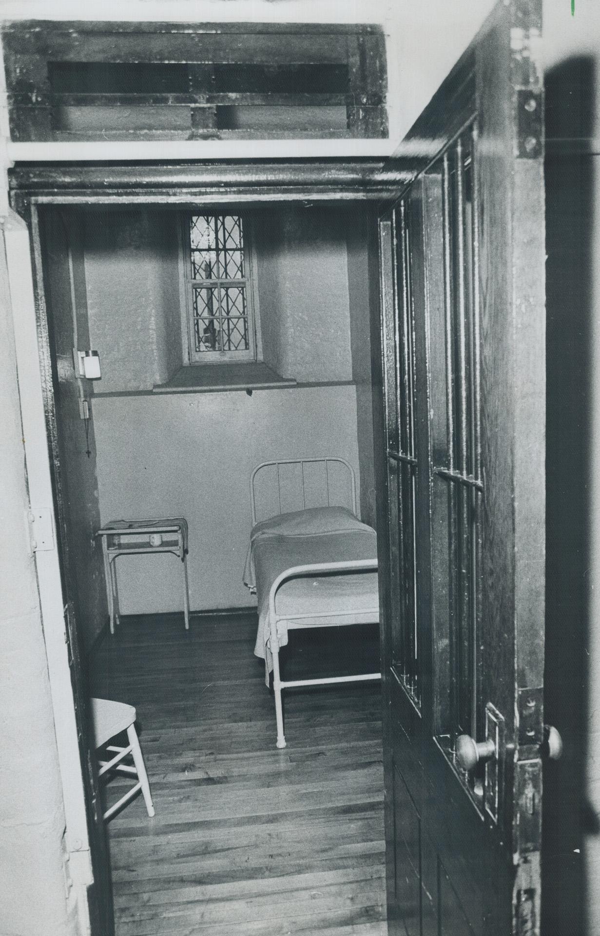
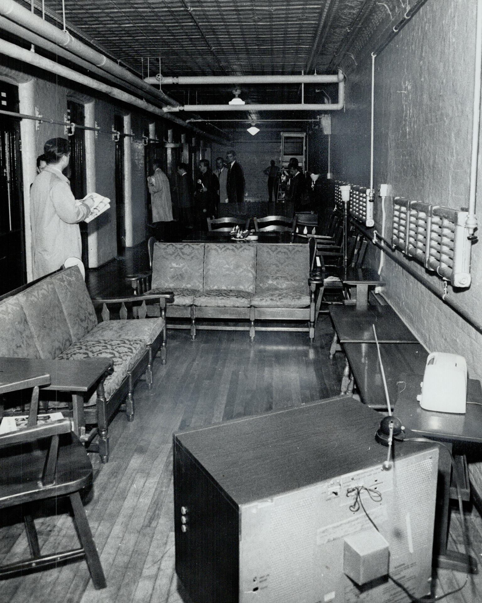
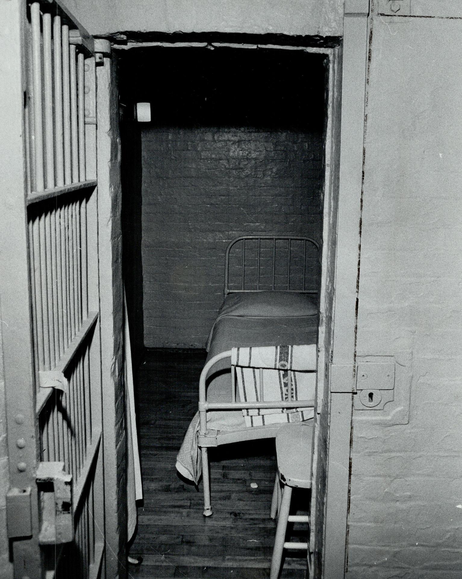
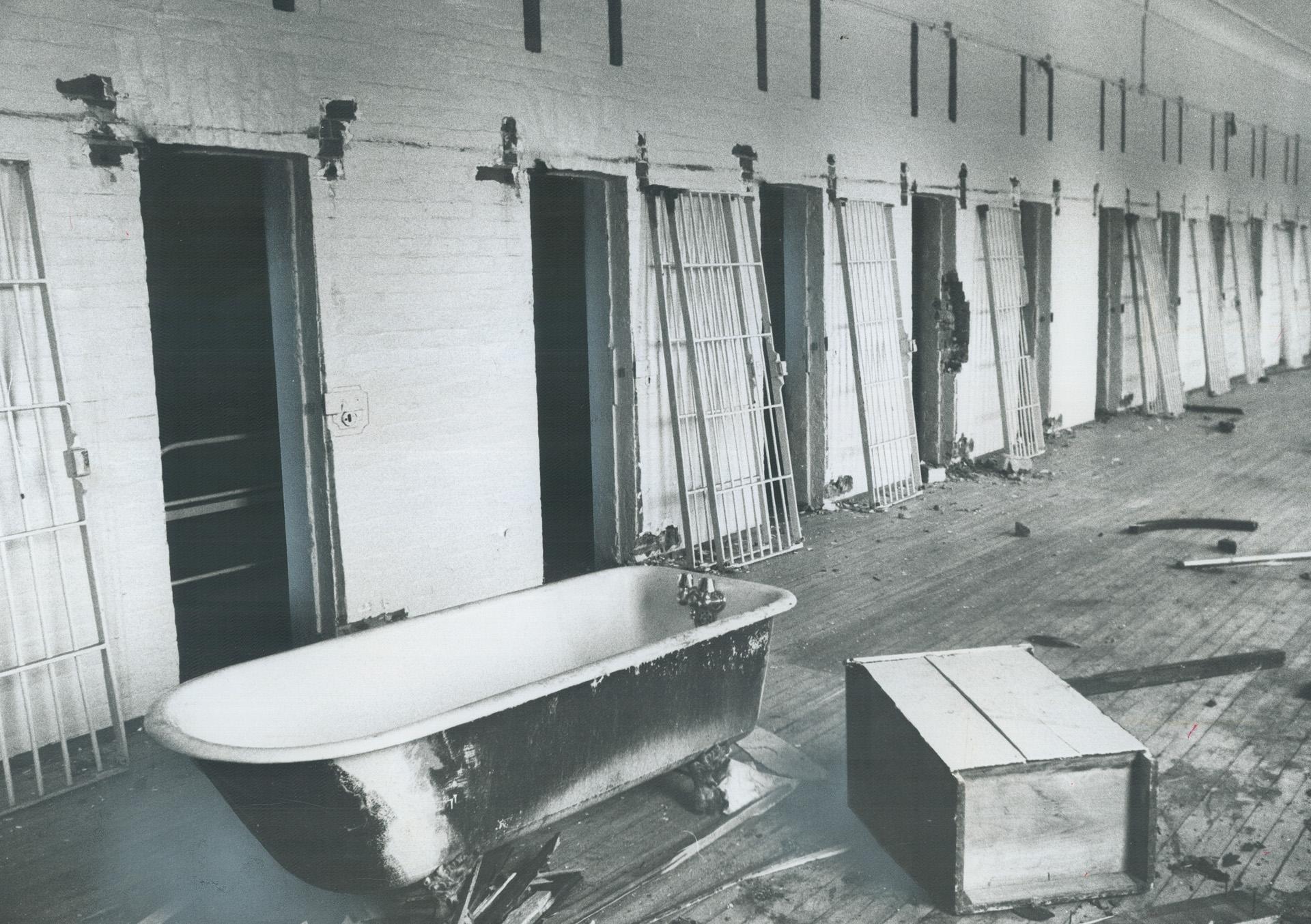
Structure Inside and Out
These photos are images of the building on the outside of the Andrew Mercer Reformatory, including photos of the inside showing the cells and corridors. These images include the original title and date the photo was taken which were sourced from Digital Archives Ontario, which is held by the Toronto Public Library.